
矢量数据处理
1. shp 格式介绍
Shapefile 文件是 ESRI 公司 ArcGIS 平台的常用格式文件,是工业标准的矢量数据文件。 Shapefile 将空间特征表中的非拓扑几何对象和属性信息存储在数据集中,特征表中的几何对象存为以坐标点集表示的图形文件—SHP 文件,Shapefile 文件并不含拓扑(Topological)数据结构。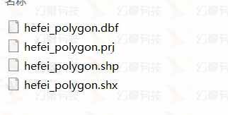
shp 一些特性:
- 1 个 Shape 文件至少包括三个文件:主文件(.shp) , 索引文件(.shx), dBASE 表(*.dbf)
- 一个 shp 文件只能存储点、线、面中的一种类型,不存在混合存在的状态;
- shp 可以设置很多字段属性
2. shp 数据来源
一般是项目相关的业务部门提供、或通过图商采购数据,也可以通过一些爬虫工具,如水经微图、 太乐地图等下载一些矢量数据。
4. geojson 格式介绍
GeoJSON 是适合于 Web 下对各种地理数据结构进行编码的格式,基于 Javascript 对象表示法的地理空间信息数据交换格式。与普通 json 文件格式区别在于对其属性及组成由一定规范。
GeoJSON 将所有的地理要素分为 Point、MultiPoint、LineString、MultiLineString、Polygon、MultiPolygon、GeometryCollection。首先是将这些要素封装到单个的 geometry 里,然后作为一个个的 Feature(要素);要素放到一个要素集合里构成。 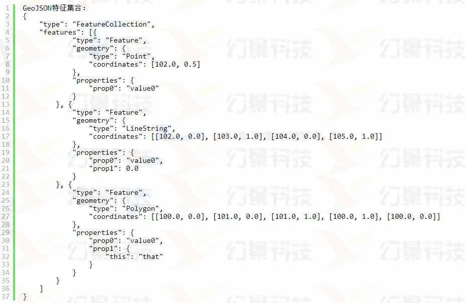
5.处理工具:GDAL 数据转换工具
shp 转 geojson 有很多工具和方式,我们推荐的是 GDAL 转换方法
5.1. 安装 GDAL 程序
下载gdal 安装程序,双击安装,一直默认即可,默认安装路径一般为C:\Program Files\GDAL,安装完成后可以打开浏览检查下。
5.2. 配置环境变量
- (1)增加系统变量 GDAL_DATA ,其值为
C:\Program Files\GDAL\gdal-data - (2)增加系统变量 PROJ_LIB ,其值为
C:\Program Files\GDAL\projlib - (3)修改 Path 变量,在 Path 值中增加
C:\Program Files\GDAL;
5.3. 转换 shp 为 geojson 命令
org2ogr 是 OGR 模块中提供的一个重要工具,用于对数据源进行格式转换,打开 cmd 命令行,参考下面输入命令:ogr2ogr -f + 导出格式 + 导出文件名称 + 源文件名称
命令(简单):
ogr2ogr -f "GeoJSON" D:\\data\\exp.json D:\\data\\企业.shp命令(支持中文 + 输出 wgs84 经纬度):
ogr2ogr -lco encoding=UTF-8 -f "GeoJSON" -t_srs "EPSG:4326" D:\\data\\exp.json D:\\data\\企业.shp5.4. 其他转换命令
(1)GeoJSON ==> ESRI Shape ogr2ogr -lco encoding=UTF-8 -f "ESRI Shapefile" -t_srs "EPSG:4326" -s_srs "EPSG:4326" E:\\data\\dth-xuexiao-fcfh.shp E:\\data\\dth-xuexiao-fcfh.json
(2)MapInfo ==> ESRI Shape
ogr2ogr -f "ESRI Shapefile" mydata.shp mydata.tab
(3)ESRI Shape ==>MapInfo
ogr2ogr -f "MapInfo File" tabsites.tab sites.shp
(4)MapInfo ==> PostGIS
ogr2ogr -f "PostgreSQL" PG:"host=localhost user=postgres dbname=postgis password=123456″
(5)postgis==>ESRI Shapefile
ogr2ogr -f "ESRI Shapefile" mydata.shp PG:"host=localhost dbname=postgis user=postgres password=123456″ "mytable"
(6)PostGIS ==> KML ogr2ogr -f "KML" neighborhoods.kml PG:"host=localhost dbname=postgis user=postgres password=123456″ -sql "select gid,name,the_geom from neighborhoods"
(7)批量转换
将 postgis 中所有的表都导出到 mydatadump 文件夹下,导出格式是 ESRI Shapefile
ogr2ogr -f "ESRI Shapefile" mydatadump PG:"host=myhost user=myloginname dbname=mydbname password=mypassword" 部分导出,将指定的表导出到 mydatadump 中,格式为 ESRI Shapefile
ogr2ogr -f "ESRI Shapefile" mydatadump PG:"host=myhost user=myloginname dbname=mydbname password=mypassword" neighborhood parcels
(8)ESRI GeoDatabase (*.mdb) ==>PostGIS
ogr2ogr -f "PostgreSQL" PG:"host=localhost user=someuser dbname=somedb password=somepassword port=5432″ C:\GISData\Geonames.mdb -a_srs EPSG:26986
导入指定的 featureclass,重投影,重命名 geometry 列
ogr2ogr -f "PostgreSQL" PG:"host=localhost user=someuser dbname=somedb" /home/postgres/Data/Geonames.mdb GEONAMES_ANNO_HYDRO -a_srs EPSG: 26986 -t_srs EPSG:4269 -nln ma_hydro -lco GEOMETRY_NAME=the_geom_4269
(9)ESRI Shapefile ==>MySQL
ogr2ogr -f "MySQL" MYSQL:"mydb,host=myhost,user=mylogin,password=mypassword,port=3306″ -nln "world" -a_srs "EPSG:4326″ path/to/world_adm0.shp
(10)Non-spatial Data ==>PostgreSQL
ogr2ogr -f "PostgreSQL" PG:"host=myserver user=myusername dbname=mydbname password=mypassword" sometable.dbf -nln "sometable"
下面是如何将 shp 和 tab 文件导入到 postgis 数据库中的命令方式
ogr2ogr -f PostgreSQL PG:"host=localhost dbname=postgis user=postgres password=850315″ sites.shp
ogr2ogr -f PostgreSQL PG:"host=localhost dbname=postgis user=postgres password=850315″ mytabfile.tab
6. 处理操作流程完整示例
6.1 下载 shp 文件
下面我们以水经微图软件下载合肥道路网为例。
1.选中合肥区域,选择“矢量数据”的道路网,文件格式为“shp”格式。 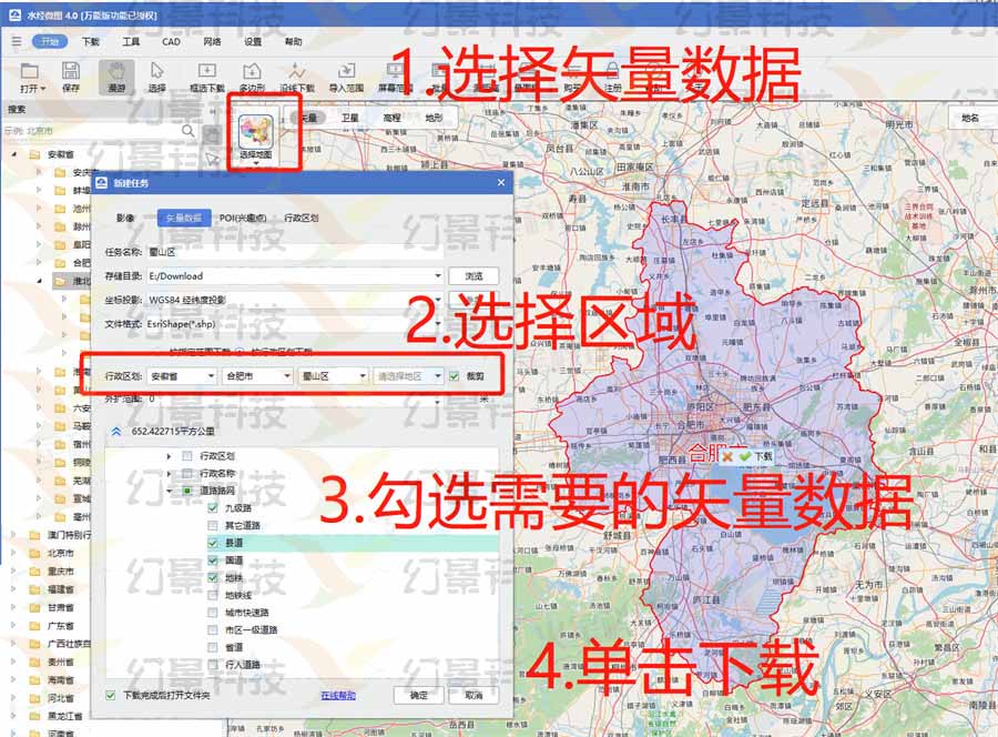 2.点击“确定”进入到下载界面
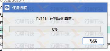
3.下载完成后数据结构如下所示: 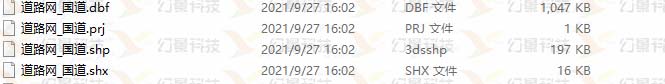
6.2 shp 格式转为 geojson
下面我们以 GDAL 数据转换工具为例,转换前确保已经按上面步骤安装好 GDAL。
1.cdm(win + R) 打开命令窗口,进入 GDAL 的目录; 或者直接打开 GDAL 下的命令窗口 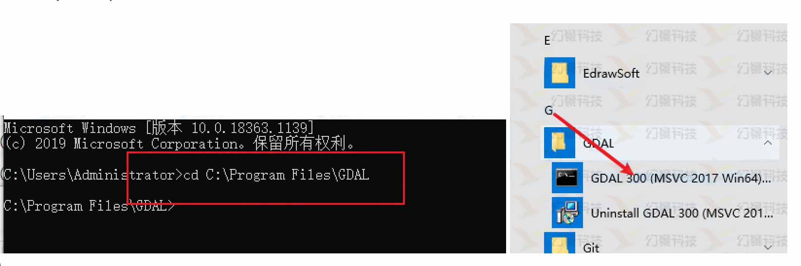 2.输入命令,进行转换
ogr2ogr -lco encoding=UTF-8 -f "GeoJSON" -t_srs "EPSG:4326" D:\\data\\exp.json D:\\data\\合肥道路.shp3.转换后的 json 文件如下 
6.3 发布二维数据为 HTTP 服务
转换成功之后将.json 文件放在项目中, 或者放在独立站点服务,可以参考发布地图数据服务。